.svg)
Precision Mapping & GIS Solutions for Smarter Land Management
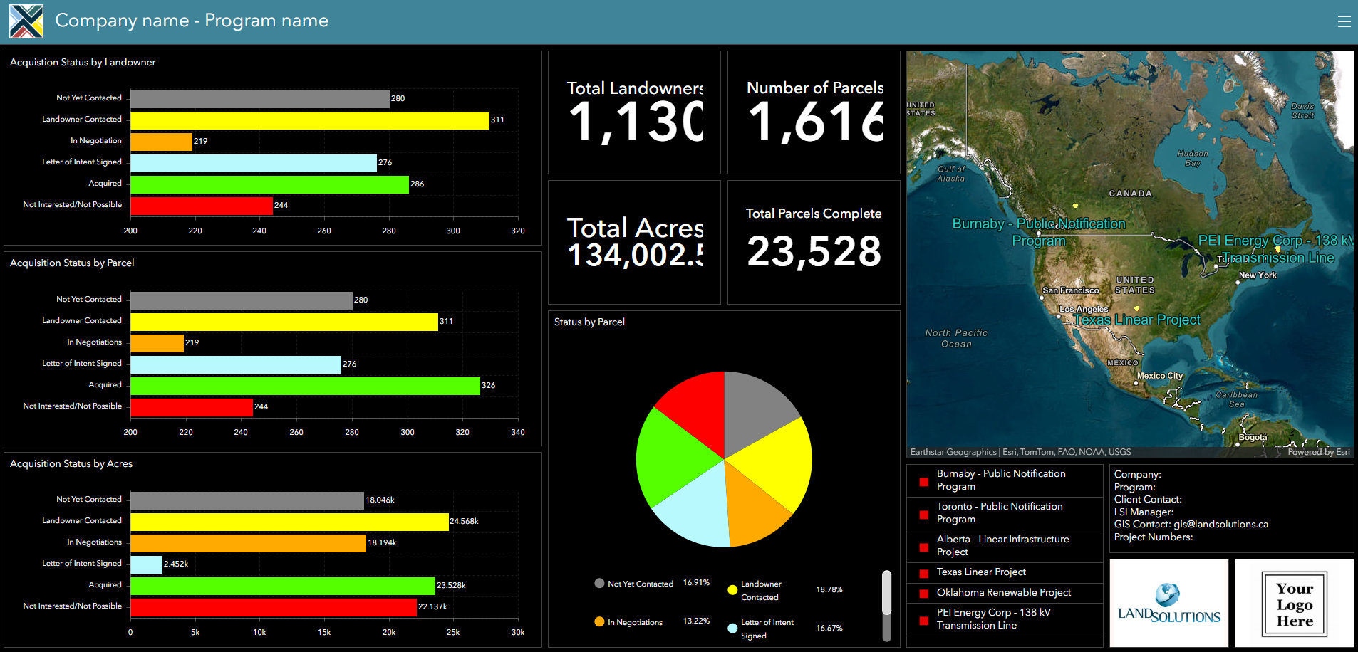
LandSolutions’ advanced GIS solutions provide precise, real-time spatial insights through project visualization, dashboards displaying recent status, and the ability to create custom project maps—empowering informed decision-making, streamlined land acquisition, and efficient project execution.
As an Esri partner we use the global GIS standard - ArcGIS Enterprise System - to turn complex data into actionable insights.