Sector Solutions

Public Infrastructure

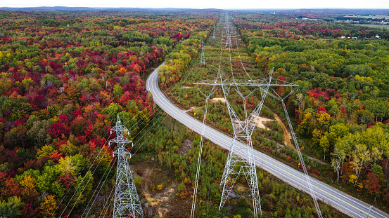
Enabling Access for Critical Public Infrastructure

LandSolutions supports the successful delivery of complex public infrastructure projects by securing the land and property rights essential to keeping them on track.

With deep experience across both large-scale government initiatives and public-private partnerships, we provide strategic land access solutions that reduce risk and accelerate progress. From highway expansions to new alignments, light rail and subways, maintenance facilities, bus rapid transit systems and all associated works, our team ensures seamless coordination, regulatory alignment, and stakeholder engagement—minimizing delays from planning through execution.

Get Started
Get Started
500+ parcels acquired across 16 major infrastructure projects

Foundations built on land expertise

Your land partner for projects that shape communities.

Project Management
Administrative Services
Tenant and Encroachment Relocations
Parcel and Title Search
Record of Contact Management 
GIS Services
Negotiations
Stakeholder Engagement
Land Obligations Management

we're in the business of elevating your business.

Land is where every project begins—securing it takes strategy, trust, and expertise.

At LandSolutions, we specialize in accessing, negotiating, and managing land and property rights to support commercial and industrial development projects. With extensive experience and a collaborative approach, we work with stakeholders to create opportunities and ensure your project stays on track and achieves its goals.

LandSolutions TECHNOLOGY
Managing project plans, engagement strategies, and location data across different systems can be time-consuming and complicated.

MapTraxx

Your All-in-One GIS Solution for Smarter Project Management

Our interactive GIS viewer, MapTraxx, solves this by bringing everything together in one place, giving you comprehensive visibility of your project, 24/7. With all your data in one view, you can make faster, more informed decisions and effectively anticipate and adapt to project changes.

MapTraxx has managed 75+ projects comprised of 70,000+ parcels since 2023.

As an Esri partner, we use the global GIS standard ArcGIS Enterprise System, to securely configure, deploy and visualize data.

Real-Time Visuals and Reporting

Reduce time spent on project reports by leveraging near real-time project visualizations

Secure Data Management and Access

Securely store, access and backup critical project data.

Project Transparency

Achieve comprehensive visibility over all aspects of your project.

70,000+ energy projects supported

Centralized Document Access

Facilitate seamless collaboration and hand-off between project teams.

Project Control and Operational Efficiency

Empower your team to identify schedule deviations for better project outcomes.

4.5+ million acres supported for projects in North America

Data Standardization and Quality Assurance

Certify decision-making data is consistent and reliable while automating updates across workflows
Get connected with your partners in land and right-of-way access.
Request Information